 West Coast Estuaries Explorer
The West Coast Estuaries Explorer
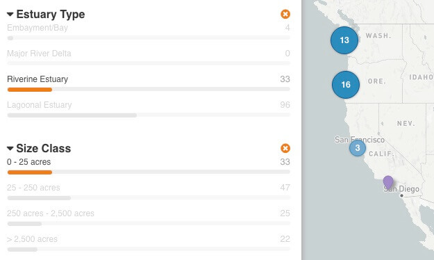
This application enables you to compare estuaries to each other along the coastlines of Washington, Oregon, and California. You can combine dynamic filters and an interactive map to find specific estuary types you are interested in, such as large river delta estuaries which often have extensive diking; small, riverine estuaries that are at the lowest risk to fish habitat degradation; or estuaries contain species that interest you. Only want to compare estuaries in a specific area? Simply zoom the map in to that area, and the filters automatically update to show you the number of estuaries in that area that meet different conditions.

You can also explore estuaries in more detail to find a specific estuary by name or location.
Click on an estuary in the map for more detailed information.
Estuary data were provided by the Pacific Marine & Estuarine Fish Habitat Partnership and the National Fish Habitat Partnership.

Estuaries provide essential habitat
Thousands of species of birds, mammals, fish and other wildlife depend on estuarine habitats as places to live, feed and reproduce. Many marine organisms, including most commercially-important species of fish, depend on estuaries at some point during their development.
In 2014, The Pacific Marine & Estuarine Fish Habitat Partnership assessed the nursery habitat potential for 15 ecologically and economically important fish and invertebrate species within Nursery Functions of U.S. West Coast Estuaries: The State of Knowledge for Juveniles of Focal Invertebrate and Fish Species.
These species were selected to encompass the diversity of life histories, habitat use, and ecological roles of species found in estuaries along the West Coast. This assessment compiled information on the presence of juveniles or the species in general within many estuaries along the West Coast. However, the estuary boundaries have been refined since that time, which means that species were assessed for somewhat different boundaries than those shown in this tool. Some records were based on large estuary systems that have since been mapped as smaller units. Not all estuaries were inventoried for species, so the absence of information about a species in a given estuary cannot be taken to indicate that the species is indeed absent from that estuary.
Focal fish species:
- Bat Ray
- Brown Rockfish
- California Halibut
- Chinook Salmon
- Coho Salmon
- English Sole
- Green Sturgeon
- Leopard Shark
- Pacific Herring
- Shiner Perch
- Staghorn Sculpin
- Starry Flounder
- Steelhead
Focal invertebrate species:
Pacific Marine & Estuarine Fish Habitat Partnership
The Pacific Marine & Estuarine Fish Habitat Partnership (PMEP) works with partners to protect, enhance, and restore ecological processes and habitats within estuaries and nearshore marine environments. PMEP focuses on enhancing juvenile fish habitat, water quality, and water quantity in nearshore marine and estuary habitats, and also on connectivity between tidal and nearshore marine areas. These efforts prioritize healthy native fish communities and sustainable human uses that depend on them.
To get involved and find out more about PMEP, available funding opportunities, and projects supported by PMEP, please click here.

North Pacific Landscape Conservation Cooperative
The North Pacific Landscape Conservation Cooperative (NPLCC) collaborated with many partners to put science to work toward more effective, landscape-level conservation. The NPLCC prioritized identification and sharing of information about natural resources throughout the region.
To access and collaborate around geospatial data within the NPLCC region, please visit the NPLCC Conservation Planning Atlas.
This application was created by the Conservation Biology Institute (CBI) in partnership with the Pacific Marine & Estuarine Fish Habitat Partnership and with financial support from the North Pacific Landscape Conservation Cooperative and National Oceanic and Atmpospheric Administration - Office of Habitat Conservation. CBI provides science and software development to support the conservation of biodiversity.
